The post and video about an obscure 1930s or ’40s alignment of Route 66 near Kingman, Ariz., sparked interest in readers. Here’s the video again, if you missed it:
The road, I surmised, would have gone south all the way to the hamlet of Harris, Ariz., had the driver kept going on a primitive road under a railroad trestle at the end of the old Route 66 alignment.
I suspected that Jim Hinckley, who’s lived in Kingman much of his life and has studied the old road extensively, would elaborate on the old section of highway. He did.
Here’s what he had to say, in part:
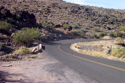
As clarification this road ends at a former race track near the original railroad crossing. This site is seen in the circa 1920 photograph at the top of Page 82 in the book “Legendary Route 66” by Michael Karl Witzel. The railroad trestle in the background of this photo is still in use.
On the other side of the tracks a small trailer park is built on this alignment. Much of the original alignment west of the canyon is erased, as numerous service stations and even a truck stop was built over it to serve the new alignment during the 1950s and 1960s.
Traces of the original road are found directly behind Dan’s Auto Salvage, a former Whiting Brothers station. Until this past year, that section of road was accessible and directly to the east was the site of a service station with an extensive dump. This is now buried under Bulldog Disposal yard.
As to Harris, I am unfamiliar. For years the city dump was in the canyon accessed by crossing under the trestle in the vintage photo. This meant the old alignment was kept in good repair. It is still utilized for access to the sewage treatment facility.
There was a great deal of mining in this area and I now of many one and two cabin mine sites in the area. As an interesting historic footnote the railroad that crosses Route 66 near Crazy Fred’s Truck Stop, a real vintage Route 66 experience, and then crosses I-40 is now a discontinued spur that linked with a small sawmill on the south side of what is now I-40.
For more photos and explanations about the old alignment, go to Hinckley’s Route 66 Chronicles site.